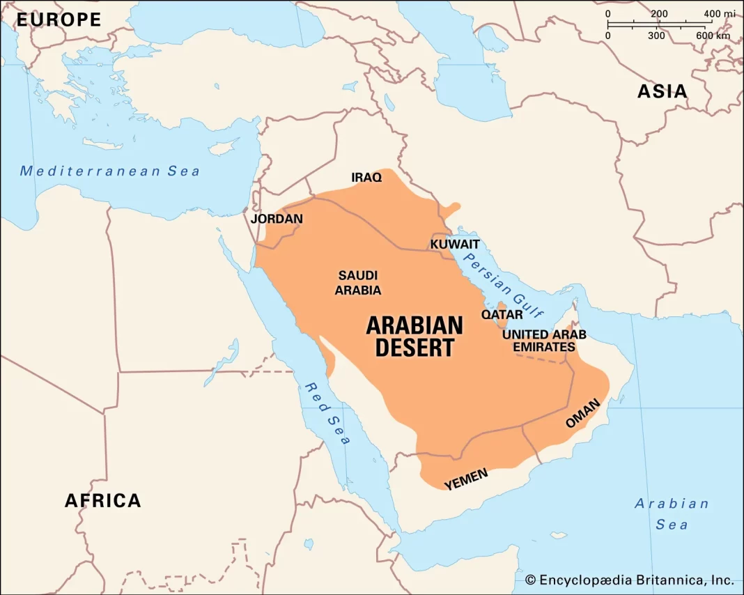
Arabia may be described as a vast plateau, edged with deeply dissected escarpments on three sides and sloping gently northeastward from the Red Sea to the eastern lowlands adjoining the Persian Gulf. The peninsula’s highest peak, Al-Nabī Shuʿayb, at 12,030 feet (3,665 metres), is located approximately 20 miles northwest of Sanaa in Yemen. About Geography of Greater Arabia ग्रेटर अरब का इतिहास

The bulk of Arabia consists of two main geomorphological areas:
The Arabian shield in the west; and sedimentary areas dipping away from the shield to the northeast, east, and southeast into the great basin consisting of lower Iraq, the Persian Gulf, and the eastern part of the Rubʿ al-Khali (“Empty Quarter”) desert. The eastern edge of the shield curves eastward from the head of the Gulf of Aqaba, a northern extension of the Red Sea, to a point midway across the peninsula and then trends southwestward and southward to the Yemeni highlands. Extinct volcanoes overlie the shield; their eruptions, which ceased seven centuries ago, produced the broad black lava beds (ḥārrahs) that are characteristic of the western Arabian landscape.
The sedimentary areas,
younger in age than the shield, represent the deposits of ancient seas. The surface sedimentary strata have been extensively eroded. The harder members, more resistant to erosion, now stand as westward-facing escarpments following the curve of the shield. The sedimentary province consists primarily of limestone, together with much sandstone and shale. The first deposits are early Paleozoic (about 400 to 540 million years old), which in eastern Arabia dip to almost six miles below the surface. In the Jurassic and Cretaceous limestone (about 65 to 200 million years old) oil and gas occur at depths of two miles or less. Some of the limestone strata take in rainfall at outcrops in the western highlands and carry it underground to the Persian Gulf coastal areas.
The Yemeni highlands are physiographically
Different from those of the shield; they are not mountains but the deeply dissected edge of the Arabian plateau. From the west the formations rise abruptly from the narrow coastal plain in Yemen; they reach heights of about 10,000 to 12,000 feet above sea level, and eastward they decrease gradually in elevation. The highlands along the southern coast are basically sedimentary in origin. The Omani highlands are geologically more closely related to the Zagros Mountains of western Iran than to other mountains in Arabia. (The sea is only about 50 miles wide at the Strait of Hormuz.)
About Geography of Greater Arabia ग्रेटर अरब का इतिहास Greater Arabia in hindi Greater Arabia related information About history of Greater Arabia Greater Arabia in hindi Greater Arabia related information About history of Greater Arabia

